

Don't be mistaken when purchasing land and housing: Official Check on the Map with TKGM Parcel Inquiry!
SITE NAME AND LINKS:
-
Site Name: TKGM Parcel Inquiry Application
-
Official URL: https://parselsorgu.tkgm.gov.tr/
-
Origin / Service Language: Türkiye (T.R. Ministry of Environment, Urbanization and Climate Change - General Directorate of Land Registry and Cadastre) / Turkish
-
Corporate Information Page: https://www.tkgm.gov.tr/
-
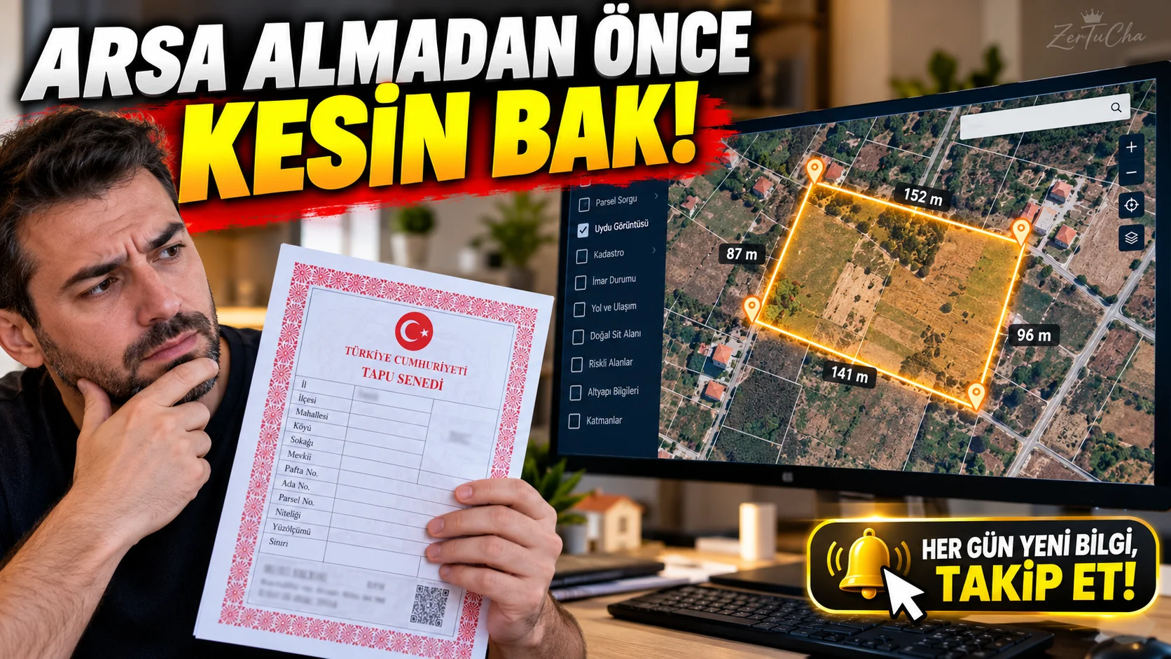
On an advertisement site, "Close to the sea, frontage to the road, coupon land!" One of the most common real estate nightmares in Türkiye is that the field you see with the title or the house you are thinking of buying actually turns out to be a parcel at the top of a mountain, without even a road. The location sent to you by the seller on WhatsApp does not always match the actual location on the title deed. At this point, instead of relying on hearsay information, you can directly open the government's official map system and check within seconds.
TKGM Parcel Query is the official web application that allows you to see the exact boundaries of that real estate on the satellite image by entering the City, District, Neighborhood/Village, Island and Parcel numbers written on the photocopy of the title deed in your hand. It doesn't just draw boundaries; the official surface area of the real estate (m²), its nature (field, plot, vineyard, garden, masonry building, etc.) and the "Analysis" tab, it also shows the trading density in that region on the map. This way, you can confirm the real situation with your own eyes at your desk before going to the real estate agent or seller.
-
STEP BY STEP USE:
-
From your browser https://parselsorgu.tkgm.gov.tr/ and accept the "Terms of Use" checkbox that appears.
-
From the inquiry panel on the left "Administrative" tab is selected.
-
On the title deed you want to examine City, District, Neighborhood/Village, Island and Parcel from the drop-down menus and "Query" button.
-
The map will automatically zoom in on that parcel and mark its boundaries with orange/red lines. "Attribute Information" box.
-
"Analysis" or click on the layer icons in the upper right to review the street view, slope status, or annual sales density heat map for that neighborhood; When you are finished, download the PDF summary or KML map file of the parcel from the information window.
-
-
REQUIREMENTS AND LIMITS: There is no membership or login requirement. It works on any computer or phone with a web browser. Bot protection (captivity verification) may occur when too many consecutive queries are made. This system only shows cadastral boundaries and title deed nature; For detailed zoning status (how many floors there are permits), you should check the e-zoning page of the relevant municipality.
-
PRIVACY AND SECURITY: It is an official public service. In accordance with personal data processing (KVKK) rules, the parcel can be viewed on this open map to whom it belongs (owner name/surname) is never displayed. You can only see the owner and annotation information of your own title deed from the "Deed Information Inquiry" screen on e-Government.
-
ADVANTAGES, DISADVANTAGES AND WHOM IT IS SUITABLE FOR:
-
Advantages: 100% official data, free, without membership, real border and road frontage control with satellite image, trading heat map analysis.
-
Disadvantages: It does not show the zoning status (construction precedent) and the name of the title deed owner.
-
Who is it suitable for: Those who are considering buying a house, land or field, those who want to find the location of inherited lands and anyone who is doing real estate research.
-
-
BRIEF CONCLUSION: It is the most basic official tool that you must open and verify the actual location and nature with the Block/Plot number before sending a deposit for any real estate. The first thing to do is to click "Analysis" tab!



Henüz yorum yapılmamış. İlk yorumu siz yapın!
Bir Yorum Bırakın